Severe Analysis

  | | | | | |  
SPC Products Overview

Saturday, November 15, 2008

Severe weather possible this afternoon!

With a strong cold front, warm weather and strong dynamics there is a possibility of severe storms this afternoon. High winds and heavy rains are the likely scenario with the chance of isolated tornadoes! This will be especially true east of I-95!

Colder air is on the way as well! More on that later!

 
Mid Atlantic Weather: http://www.midatlanticweather.com
Mid Atlantic Weather Forum: http://www.midatlanticweather.com/bb3


Sunday, August 10, 2008

Severe Storms likely today

A disturbance will move through the region today and cause storms which could be severe. Very heavy rains, hail, and high winds, and hail are the biggest threats. There could be some isolated tornadoes, especially in the east.

Stay tuned to weather outlets for watches or warnings!

All for now

Mid Atlantic Weather: http://www.midatlanticweather.com
Mid atlantic Weather Forum: http://www.midatlanticweather.com/bb3


Tuesday, August 05, 2008

Severe weather possible this afternoon and evening

Severe weather is a strong possibility later this afternoon and evening. Hail and damaging winds are the biggest threat, but isolated tornadoes are also possible.

The good news is that this is the beginning of a weather shift and very nice conditions are becoming more likely for this weekend!

Stay tuned to your weather outlets for watches and/or warnings.

All for now!

Mid Atlantic Weather: http://www.midatlanticweather.com
Mid atlantic Weather Forum: http://www.midatlanticweather.com/bb3


Sunday, July 27, 2008

Severe is possible today

Several showers and storms shoud erupt this afternoon throughout teh area and some may bcome severe. Today's threat would be high winds and hail.


Please stay to news and radio outlets for watches and/or warnings.


All for now!

Mid Atlantic Weather: http://www.midatlanticweather.com
Mid atlantic Weather Forum: http://www.midatlanticweather.com/bb3


Wednesday, July 23, 2008

Heavy rains and severe weather

Ongoing scattered thunderstorms with locally intense rains will become more widespread today. The atmosphere is extremely saturated and storms have the capability of dropping several inches of rain in some locations which would cause flash flooding. On top of this, the atmosphere is unstable enough that damaging winds and hail in some storms is very likely!

Please stay alert today! Stay tuned to weather outlets and NEVER drive through water that you see crossing over a street! This will be a very busy weather day!


Mid Atlantic Weather: http://www.midatlanticweather.com
Mid atlantic Weather Forum: http://www.midatlanticweather.com/bb3
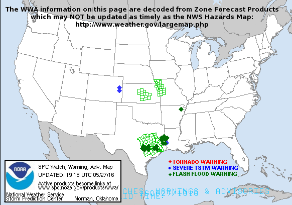

Tuesday, July 22, 2008

Fairly high chance of severe weather

Severe storms could affect the area by early afternoon. Heavy rains and high winds appear likely. Please stay tuned to weather outlets for updates and potential watches and/or warnings.

All for now!


Mid Atlantic Weather: http://www.midatlanticweather.com
Mid atlantic Weather Forum: http://www.midatlanticweather.com/bb3
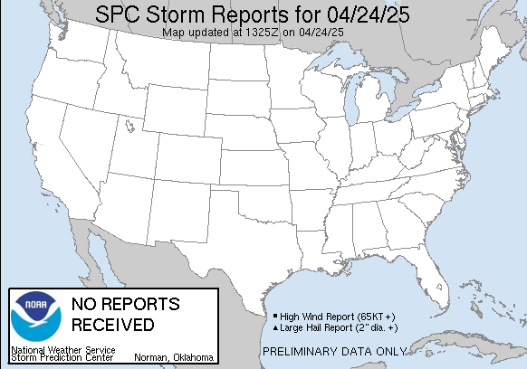

Wednesday, July 09, 2008

Some severe storms likely today with heavy rains

A cold front will push through the region the next 24 hours and likely bring heavy rains and thunderstorms which could be severe.Please  stay tuned to weather outlets for Watches and/or warnings this afternoon.

All for now!

Mid Atlantic Weather: http://www.midatlanticweather.com
Mid Atlantic Weather Forum: http://www.midatlanticweather.com/bb3


Sunday, June 29, 2008

Severe storms likely to develop with numerous showers and storms this Afternoon

Storms will develop and persist through the afternoon. The atmosphere will be very unstable so severe weather will be likely to develop. The biggest risk will be high winds. Hail and isolated tornadoes could also occur.

Stay tuned to news and radio outlets for watches or warnings.

Mid Atlantic Weather: http://www.midatlanticweather.com
Mid atlantic Weather Forum: http://www.midatlanticweather.com/bb3


Friday, June 27, 2008

Severe Storms possible today though Monday

There is a risk for Scattered storms which could become severe with High winds and Hail this afternoon and evening. The best risk of severe weather today will be Northern Virginia and Maryland. Please stay tuned to Radio, News, or other weather outlets for watches or warnings.

The Severe weather threat should exist through the weekend and into Monday with the best Chance Sunday and Monday. The Severe weather could affect anyone in the entire area this weekend and Monday.

All for now.
 
Mid Atlantic Weather: http://www.midatlanticweather.com
Mid Atlantic Weather Forum: http://www.midatlanticweather.com/bb3


Monday, June 23, 2008

Afternoon storms with scattered Severe!

The atmosphere is very unstable so afternoon showers and thunderstorms are likely today. Some will be severe and will likely produce damaging winds, hail, and isolated tornadoes. Stay tuned to weather outlets for watches and/or warnings this afternoon.

We will see more tranquil weather the next few days and then summer heat and humidity will return Thursday!

All for now!
 
Mid Atlantic Weather: http://www.midatlanticweather.com
Mid Atlantic Weather Forum: http://www.midatlanticweather.com/bb3


Sunday, June 22, 2008

Severe weather very possible today!

An approaching frontal system will increase the likelihood of showers and thunderstorms this afternoon. Storms could become severe and the threat exists for hail, high winds, and isolated tornadoes. Please stay tuned to local weather outlets for watches and warnings.

Severe weather could also be an issue for part of the day tomorrow. More to come on this.
 
Mid Atlantic Weather: http://www.midatlanticweather.com
Mid Atlantic Weather Forum: http://www.midatlanticweather.com/bb3


Monday, June 16, 2008

Severe weather likely this afternoon!

This will likely become a stormy day as a front approaches and drops temperatures and humidity for the next several days! The threats today will include high winds, hail, and isolated tornadoes.

Please stay tuned to weather and media outlets. I will try and update as possible.

Jimmy
 
Mid Atlantic Weather: http://www.midatlanticweather.com
Mid Atlantic Weather Forum: http://www.midatlanticweather.com/bb3


Tuesday, June 10, 2008

HOT weather will give way to strong storms

The very hot weather we have been experiencing will last one day more, but give way to showers and storms later today. These storms could contain strong winds, hail, and even isolated tornadoes towards the Chesapeake bay region. Please stay tuned to local news and weather outlets and try and stay cool for one more day.

All for now!

Jimmy

 
Mid Atlantic Weather: http://www.midatlanticweather.com
Mid Atlantic Weather Forum: http://www.midatlanticweather.com/bb3


Wednesday, June 04, 2008

Severe weather to continue today

Scattered Severe storms along with the potential for heavy rains and possible isolated tornadoes will continue today. Sorry to all for no early heads up on last night's system that caused some damage in some locations and a lot of rain! A second impulse will cross the region this afternoon!
 
Mid Atlantic Weather: http://www.midatlanticweather.com
Mid atlantic Weather Forum: http://www.midatlanticweather.com/bb3


Saturday, May 31, 2008

Severe Weather with Tornadoes Possible

Tornado watches have gone up for parts of the region and the atmosphere is unstable today. Please stay tuned to news and weather outlets!


Mid Atlantic Weather: http://www.midatlanticweather.com
Mid Atlantic Weather Forum: http://www.midatlanticweather.com/bb3


Thursday, May 08, 2008

Severe weather with Tornadoes!

Severe thunderstorms are likely or occurring for many locations! The atmosphere is primed for some severe weather including tornadic activity. Warnings have been issued in many locations in Southwestern Virginia! This is serious and you need to stay informed of the weather this evening!

Very heavy rains are also very likely! Please be careful and stay tuned to your news and weather outlets!
 
Jimmy
 
Mid Atlantic Weather: http://www.midatlanticweather.com
Mid Atlantic Weather Forum: http://www.midatlanticweather.com/bb3


Be a better friend, newshound, and know-it-all with Yahoo! Mobile. Try it now.

Wednesday, March 19, 2008

Severe weather and then SNOW?

A strong cold front will approach teh are today and produce some strong to possibly severe storms. The biggest threat will be strong winds, but some risk is there for isolated tornadoes. Please stay tuned too radio and news outlets today.

The SNOW potential is real for late in the Weekend and early next week. So much time to evaluate, but a real threat nonetheless an it could be significant.

All for now!

 
Mid Atlantic Weather: http://www.midatlanticweather.com
Mid atlantic Weather Forum: http://www.midatlanticweather.com/bb3


Looking for last minute shopping deals? Find them fast with Yahoo! Search.

Tuesday, March 04, 2008

SEVERE WEATHER LIKELY AND HEAVY RAINS

SEVERE WEATHER LIKELY AND HEAVY RAINS

If you have been listening to the news and weather you will know many areas are under a tornado watch. I thought I should post and say that this is a higher risk than normal for more serious tornadoes. If there are any they are likely to be isolated, some may be strong. This is not a night to disregard this potential. Severe storms are also firing and producing winds in excess of 70 mph! This is a serious situation and I would ask that you pay attention to your news and radio outlets into the night!

In addition, very heavy rainfall could result in flooding. Remember, water is powerful and can sweep even larger vehicles off the road.
 
Mid Atlantic Weather: http://www.midatlanticweather.com
Mid atlantic Weather Forum: http://www.midatlanticweather.com/bb3


Looking for last minute shopping deals? Find them fast with Yahoo! Search.

Wednesday, February 20, 2008

winter Storm Watches posted. Messy Friday into Saturday!

The national weather service has come out with Watches and this looks like a long term icing event starting as snow most areas tomorrow night. The surface cold will mean that the warming taking place aloft will not make it to the surface so Ice will become a dominant type. this will be especially true west of I-95, but MOST areas could see an ice storm before warming.

There are still details to be concerned about. Some models show less precipitation than others. If the less precip pans out, advisory criteria (icing less than .25"would more the likely outcome)

Now, I am thinking that the combination of Ice and Snow will be enough for the storm and we will all need to watch this.

Break down:
I-95 and east - Advisory criteria
I-95 and West - Winter Storm

Snow 1-4" (more western slopes and near PA border)
Ice will be an issue through most of Saturday.

All for now.
 
Mid Atlantic Weather: http://www.midatlanticweather.com
Mid Atlantic Weather Forum: http://www.midatlanticweather.com/bb3


Be a better friend, newshound, and know-it-all with Yahoo! Mobile. Try it now.

Tuesday, February 19, 2008

Light Snow tomorrow. Ice Storm Friday!

Light Snow will overspread the northern Half of Virginia and Maryland tomorrow. 1 to as much a 3 inches will fall, from Fredericksburg northward with the near 3" occurring in Maryland. 3-5" is expected in the higher, western facing, mountains.

Friday could be a very slippery day with widespread icing issues and maybe some accumulating snows. This could include most of the area, especially west of I-95. More northern areas could squeeze out enough snow at the onset to be  Winter Storm Warning Criteria for snow (>4") and then many areas could be under a storm warning for Ice!

Details still coming on the later week storm, but look for snow to overspread the area quickly tomorrow morning and last until evening.
 
Mid Atlantic Weather: http://www.midatlanticweather.com
Mid Atlantic Weather Forum: http://www.midatlanticweather.com/bb3


Never miss a thing. Make Yahoo your homepage.

Wednesday, February 13, 2008

Ice troubles continue this morning. Some snow this afternoon!

The ice continues most of the night and has been really a problem for the central piedmont. Be extremely careful especially on secondary streets and walking!

The snow threat this afternoon and evening looks less impressive than I may have thought, but bears watching as models do not get these scenarios correct often. I am not saying we will get more than foretasted, I am saying it is very hard to forecast.

Why was it so much colder? My only real thoughts on this was that the storm that is to the west was not as strong as foretasted which meant the southerly winds were not as strong as thought. These winds would have warmed the atmosphere and switched things to rain yesterday instead of this morning. Also, the secondary low that could  cause some snow this afternoon and evening could affect the scouring of the cold as well.

The week will remain fairly cold with the next threat of wintry weather Sunday night into Tuesday!

All for now!

 
Mid Atlantic Weather: http://www.midatlanticweather.com
Mid Atlantic Weather Forum: http://www.midatlanticweather.com/bb3


Looking for last minute shopping deals? Find them fast with Yahoo! Search.

Ice isses continue for Piedmont - snow tomorrow into tomorrow night!

The cold air will slowly erode, but it is going to take some time so ice will be an issue until morning! In the morning we may see some plain rain before temperatures bottom out a new coastal low forms. There is a chance for 1 - 4" of snow especially I-95 and eastward and especially north of I-95

This was a very strange set up and I missed it as many did! The situation tomorrow is an evolving one and may surprise us again!

I will update as soon as I can!

 
Mid Atlantic Weather: http://www.midatlanticweather.com
Mid Atlantic Weather Forum: http://www.midatlanticweather.com/bb3


Never miss a thing. Make Yahoo your homepage.

Tuesday, February 12, 2008

SOME SLEET AND FREEZING RAIN THREAT TODAY

Mainly areas along and Right up against the mountains, especially valley locations, will see a period of light snow today, mixing with and changing to sleet and freezing rain. Accumulations look light but people should be careful because the ground is so cold that it will accumulate and cause trouble when driving. precip will change to rain as the day progresses and should all b rain by this evening. Areas today affected will be just west of I-95 with more accumulations the closer you are to the mountains. Some sleet will mix in at the onset of most precipitation area wide.

Tomorrow night bears some watching as a quick burst of snow may occur over eastern regions! More to come on that!
 
Mid Atlantic Weather: http://www.midatlanticweather.com
Mid Atlantic Weather Forum: http://www.midatlanticweather.com/bb3


Looking for last minute shopping deals? Find them fast with Yahoo! Search.

Wednesday, January 16, 2008

SNOW ALERT! Snow amounts increasing due to radar coverage

Snowfall for the next system has been upped by the NWS. Many areas west of I-95 have been sent to a Winter Storm Warning. It appears that 4"+ of snow will fall in these regions. Higher amounts will occur near and in the mountains.

Snow is now likely to break out near daybreak in the DC metro area. Snow will fall and become heavy at times west of I-95.

Best I can tell from what i am seeing.

A line from Roanoke, to Harrison burg to Leesburg through middle of Frederick County Maryland will see the most snow.

yes.. I kind of fell asleep at the wheel on this one! Again.. snowfall I think will generally be 3-6" east of the immediate piedmont and 4 - 8" in higher elevations.

This has a very high likelihood too change!


Mid Atlantic Weather: http://www.midatlanticweather.com
Mid Atlantic Weather Forum: http://www.midatlanticweather.com/bb3


Never miss a thing. Make Yahoo your homepage.

Tuesday, January 15, 2008

Messy mix probable Thursday and Thursday Night

There is a fairly strong chance that a mix of snow, rain,freezing rain, and sleet will be occurring Thursday and Thursday night.

This is especially true of the Piedmont and mainly west of I -95. Areas of higher elevations could see some accumulating snow before a mix also comes into play there. Not a lot of time so this will be all for now! Please note, that, unlike the last 2 storms, more cold air is already in place before the start of the system.
 
Mid Atlantic Weather: http://www.midatlanticweather.com
Mid Atlantic Weather Forum: http://www.midatlanticweather.com/bb3


Looking for last minute shopping deals? Find them fast with Yahoo! Search.

Sunday, January 13, 2008

Not much snow- Potential later this week - brutal cold coming!

Just not cold enough and a storm that will not get its act together until too late! So we will see rain and many places will likely see a mix at some point overnight, but accumulations are not likely. I could see a dusting and I still feel a bit worried about abandoning accumulations, but i am not getting the Forecast Model support. I will need to watch maps today and this evening to be sure I do not have to reverse course, but again, this winter, we have to call off a real snow alert and just make you aware of the possibility for some snow later tonight.

This week will be a busy one with another possible winter system Thursday/Friday and then a brutally cold snow this coming weekend! Highs may stay in the teens to even single digits in the mountains. Systems could be poised for more snowy concerns next week as we stay pretty cold!

So the key here, less chances of snow.. a seasonable weather week, another chance of wintry weather Thursday and Friday followed by the coldest cold of the season!

Hang on for the bumpy ride!

More later!
 
Mid Atlantic Weather: http://www.midatlanticweather.com
Mid Atlantic Weather Forum: http://www.midatlanticweather.com/bb3


Never miss a thing. Make Yahoo your homepage.

Saturday, January 12, 2008

Snow threat still there for Northern VA and Maryland - Not enthusiastic about a big storm.

Trends on models have been to get this storm together later than would be needed for a larger snowstorm in the area. that being said, some details are obviously not know, and this one has a chance to surprise us. The forecast models have shown a move further east and north with the precipitation. This trend may continue or could be wrong. I am certain some precipitation will fall tomorrow and tomorrow night. I am also fairly certain areas will see snow after some rain for a while. I am not certain if much more than 1  to 3 inches would fall. Areas likely to see snow after a mix would actually be along and just east of I 95 north of Fredericksburg and this would happen tomorrow night. Areas west of I 95 north of Fredericksburg and just up and east of the Piedmont could see a 1 to 2" snow. If models continue to trend unfavorable for heavier precipitation, rain may not turn to snow until right at the end. On the other hand, there may be some more adjustments

So I am not enthusiastic about a big storm, and I am concerned by the trends. They could reverse and we could see more snow so this one is going to be a tough one!

More to come!
 
Mid Atlantic Weather: http://www.midatlanticweather.com
Mid Atlantic Weather Forum: http://www.midatlanticweather.com/bb3


Be a better friend, newshound, and know-it-all with Yahoo! Mobile. Try it now.

Friday, January 11, 2008

Continued chance of wintry weather Sunday.. details are fuzzy!

There will be a storm and there is the distinct possibility of snow, but the temperatures at the surface may just be warm enough that accumulations become somewhat limited. There may also be a lot of forecast model issues at this time that are causing me to think less of the storm for the time being. The possibilities still run the spectrum from rain most place to more snow, and the lighter or heavier amounts. Now it looks fairly certain there will be some wintry weather in the region, the amounts and impact are way too early to detail.

Next week looks cold and also has another potential snow threat later in the week. We are entering an active winter pattern!
 
Mid Atlantic Weather: http://www.midatlanticweather.com
Mid Atlantic Weather Forum: http://www.midatlanticweather.com/bb3


Be a better friend, newshound, and know-it-all with Yahoo! Mobile. Try it now.

Thursday, January 10, 2008

Potentential Significant Winter Storm Sunday into Monday!

Situation will need to be monitored but it appears a strong Nor'easter may be ready to blast the region with Heavy precipitation Sunday into Monday. Preliminary model output does put areas in a risk for significant wintry precipitation. This has shown up several times on models in the past and then changed dramatically so I will continue to monitor!

All for now!
 
Mid Atlantic Weather: http://www.midatlanticweather.com
Mid Atlantic Weather Forum: http://www.midatlanticweather.com/bb3


Looking for last minute shopping deals? Find them fast with Yahoo! Search.